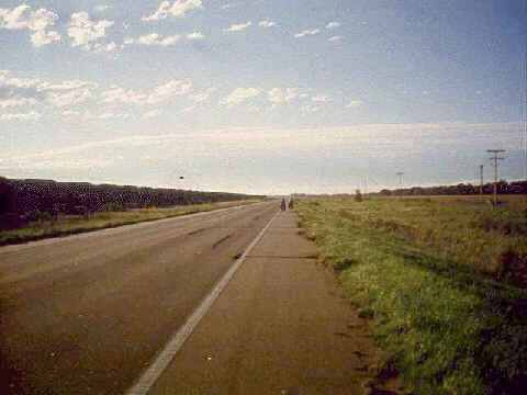
Nebraska is FlatNebraska is flat. This is a typical scene as we biked through Nebraska. There was a road straight as an arrow and flat as a pancake. On one side was a railroad track stretching for as far as you could see and on the other side of the road were corn fields. Sometimes the view would change by having the tracks on the opposite side of the road. If you peered onto the horizon as you left town you could make out the vague image of a water tower and a set of grain elevators. This was the next goal for the day. It indicated the next town which was 10 - 12 miles ahead on the road. As you got closer, your view of the water tower and grain elevators got clearer. Town was the next opportunity for a cold drink, food and a rest room. Then you passed through town and began the process again. |
|
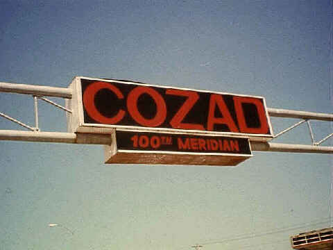
Where the Arid West Meets the Humid EastOnce we got onto the plains the humidity levels were noticeably higher than in the mountains. The air felt heavier and wetter. My brow and skin were damper with sweat also. The 100th meridian is supposedly where this happens. It actually happened further west than this. The early explorers believed that the land west of the 100th meridian could not support life. The Bureau of Land Reclamation sure proved them wrong! But without that substantial intervention from humans not much life could have been sustained in many of the western areas through which we had biked. |
|
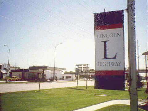
The Story of Small Town USASo many of the small towns that we rode through were little more than shells of their former selves. There are a lot of reasons why these towns dried up. One of them we evidenced first hand as we biked across Nebraska on US Highway 30 - The Lincoln Highway. I remember learning about the Lincoln Highway in 4th grade geography class. Prior to building the Interstate Defense Highway System (yes, it was originally approved as a necessity for national defense) US 30 was one of the major east-west roads across the US. The US population, with new mobility gained from the automobile, passed in droves through these small towns. But then when the Interstate went through all of that traffic bypassed town at 65 mph. It is not too clear in the photo but the road signs show US 30 going straight and Interstate 80 off to the left. Many times when we asked for a place to eat we were told that there was nothing in town and we would have to head up to the Interstate exit some number of miles away. This is another aspect of the US landscape and history that is not seen by the motorized tourist. |
|