|
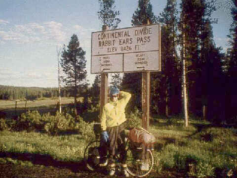
A Day of Four SevensWe crossed the Continental Divide at Rabbit Ears Pass near Steamboat Springs, CO. Coming from West to East has an advantage with getting acclimated to the altitude. (And I won't believe anyone again if they tell me there is an advantage with the winds also. NOT!) None of us had any problems with this 9,000+ feet elevation. We had been above 5000 feet for the last two weeks and were well adjusted to the altitude. The day from Steamboat to Rabbit Ears was a day of four 7's. It was 7 miles flat out of Steamboat, then 7 miles up at a 7% grade and we ended the day with 7 miles along the flat topped Rabbit Ears Pass to our campground on the Pass. You can't quite see me making rabbit ears over my head with my lobster claw gloves. |
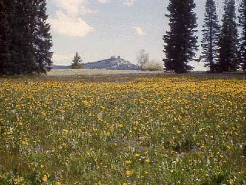
Wildflower FieldHere is a view of the peak at Rabbit Ears that gives the pass its name. The twin rock outcropping reminded some early settler of the ears on a rabbit. This photo doesn't really do justice to how gorgeous this field of wildflowers was. |
|
|
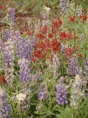
WildflowersThroughout the trip we saw many flowers and other plants but none were as pretty as the wildflowers on Rabbit Ears Pass. |
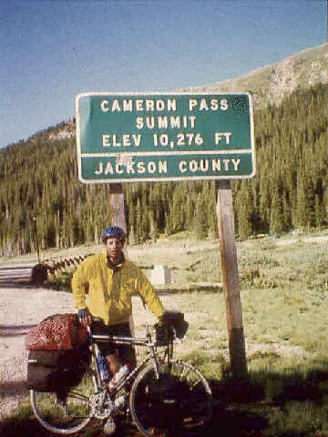
Cameron Pass - The High Point of the TripThe highest point on our trip was reached here on Cameron Pass. The climb from Gould, CO this morning was so gentle that we barely felt like it was a pass. This was another cold mountain morning with all of us needing to bundle up fully before climbing on the bikes. The morning temperatures were in the low 30's maybe even upper 20's. |
|
|
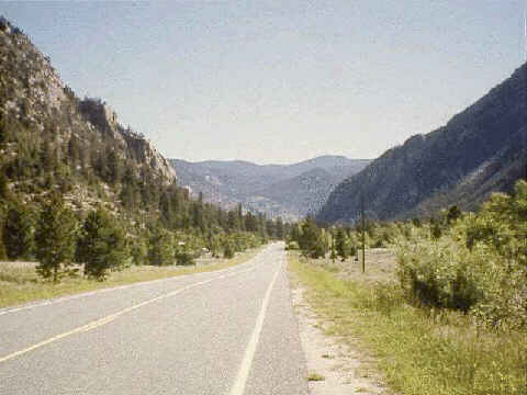
Poudre Canyon - 55 Miles of DownhillSo, once we had gotten to the high point it would be all downhill until the end of the trip. Well, not exactly, but we did get a 55 mile downhill run through Poudre Canyon. The road leveled out in some areas but never went back up before we left the mountains and headed into Fort Collins, CO. Since we were in no big rush and had been warned about riding this narrow road on a summer Sunday afternoon, we took half the downhill today and saved the rest for the next day. It was in this section that we had our one very close call with a motor vehicle. I thought Maureen and Art were going to be road splat by this recreational vehicle or at least by the sport utility that it was towing behind. |
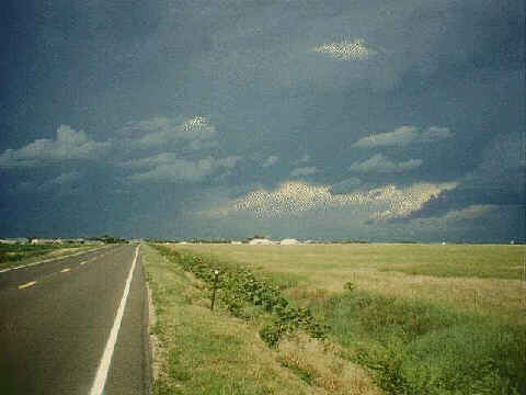
A Storm on the PlainsOnce we got onto the plains our mileages increased noticeably. This photo is at the end of the day as we are riding into Julesburg, CO. The wheat fields were ready for harvest and the sun lit them up to a bright golden glow. But the sky beyond looked very ominous. We actually had to ride into that blackness. When we got to Julesburg sirens were blaring. Thinking that it was a tornado alert, we headed to Town Hall to find out where the shelter was. We were then informed that the sirens were only from the local factory and that the campground a Colorado Highway Patrolman told us was here did not exist! This seemed like a good night for a motel and saved us from being out in this nasty storm when it finally did roll through. And today was the first century ever for me. 100.3 miles made it official! |
|