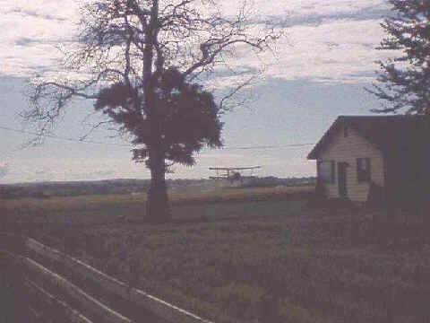
It DID Miss the HouseIt sure looks like this crop duster is going to plow into that building. As I approached the area with Maureen, we heard the plane and occasionally saw it rise above the treetops and quickly disappear again. The only thing I could think was that the plane was flying up and down along a cliff and we were headed to some massive downhill. We saw otherwise when we got up closer. The pilot appeared to be having a great time flying around but it was probably just a job. This photo was taken just on the Oregon/Idaho border and it marks a change in terrain to the highly agricultural landscape of Idaho. We saw several other crop dusters along the trip including the one in Wyoming which made us wait while it refilled with chemicals and then used the road we were on as a runway! |
|
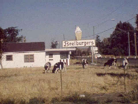
Do-It-Yourself Burger StandThis is either a D-I-Y burger joint where you can get super raw hamburgers or it is the final revenge by some relatives of cows long ago eaten as hamburgers. This was taken in Hammett,ID. |
|
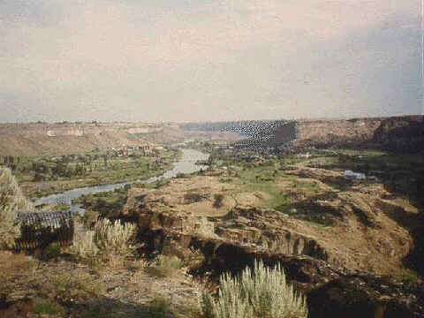
Snake River ValleyThis is a view of the lush Snake River Valley looking west from the Perrine Bridge in Twin Falls, ID. A few miles east of here is where Evil Knievel tried to ride his motorcycle across a canyon. As I rode along on the plateau above the river, I often wondered about the first settlers coming West. We were following the Oregon Trail as it passed through much of Idaho. The plateau had a barren landscape except in those areas that were heavily irrigated for argriculture. The early settlers pressed on with only the hope that what lie ahead was better than what they had. From the plateau there is no indication of the river below even when less than a mile from the gorge. Coming upon this fertile valley must have bouyed their spirits. |
|
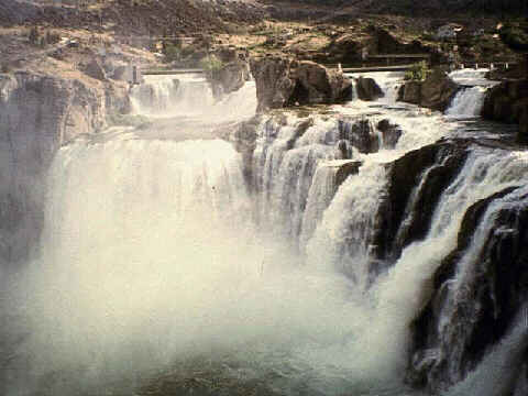
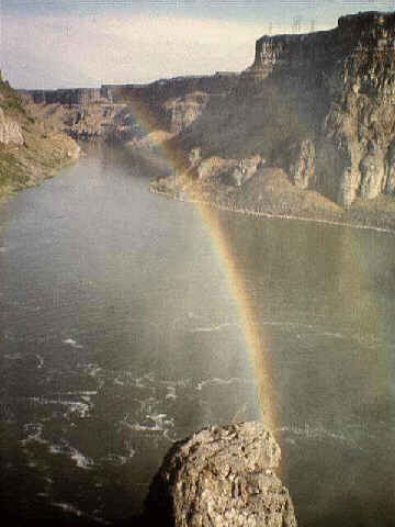
Shoshone Falls - "Niagra of the West"Shoshone Falls is credited as being taller than Niagra Falls by 52 feet. The photo here is at average water flow. In the Spring and early Summer all water from the Snake River is diverted for agricultural use. I have a postcard showing the Falls at low level and the rocks are completely dry. In the winter time, the flow is so large that you can not see any rocks. Bill and I biked down to see the Falls. It was about 1 mile down a very steep twisty road. Both of us expected that the climb back up would be difficult (this was early morning on one of our 90 degree days). After climbing out we both realized that after two weeks of riding we were in much better shape than when we started. The climb barely phased us. |
|
RainbowsJust as with Niagra Falls, whenever the sun is out there is a rainbow from the water spray here at Shoshone Falls. Throughout the trip we saw several rainbows, mostly after storms. This was one that did not fall into that category. You can even just make out the second rainbow to the right. |
|
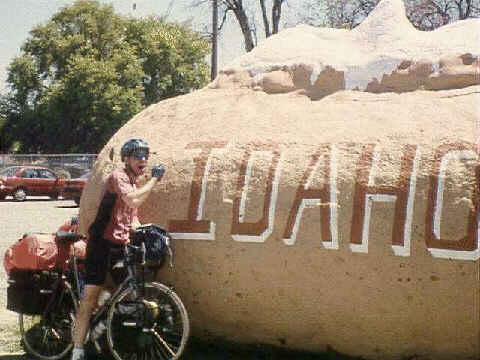
Where the Potato is KingAs we rode through Blackfoot, ID, we passed an exhibition hall where the annual Potato Exhibit was being held. I saw this potato and yelled out to the group, "I've gotta stop for a picture of this!" That generated some chuckles from the people standing on the sidewalk. We all took a round of photos here. This was one of the only days on the entire trip when we had a tailwind. There was a great southwest wind and the Snake River, which we had been following across the state, heads in exactly this direction in this eastern part of Idaho. The wind blew us from Massacre Rocks to Idaho Falls. It was our longest day so far - almost 95 miles - and my longest ride EVER. Still no century though! |
|